8 Best Hunting GPS Handhelds (April 2026) Expert Reviews
Table Of Contents
I learned the hard way that smartphones and backcountry hunting don’t mix. Three years ago, my phone died on day two of a five-day elk hunt in Colorado – cold temperatures drained the battery faster than expected, and I found myself navigating by memory and landmarks. That experience taught me why dedicated hunting GPS handhelds remain essential gear for serious hunters.
After testing dozens of units across multiple hunting seasons, I’ve identified the best hunting GPS handhelds that actually perform when you need them most. Whether you’re tracking through dense timber, navigating public land boundaries, or marking waypoints to your tree stand, these devices provide reliable navigation that smartphones simply cannot match.
In this 2026 guide, I’ll share my hands-on experience with 8 top-rated GPS units, ranging from budget-friendly basics to premium models with satellite messaging. Each recommendation comes from real field testing in actual hunting conditions – not just spec sheet comparisons.
Top 3 Picks for Best Hunting GPS Handhelds
Before diving into detailed reviews, here are my top three recommendations based on extensive field testing:
We earn a commission, at no additional cost to you.
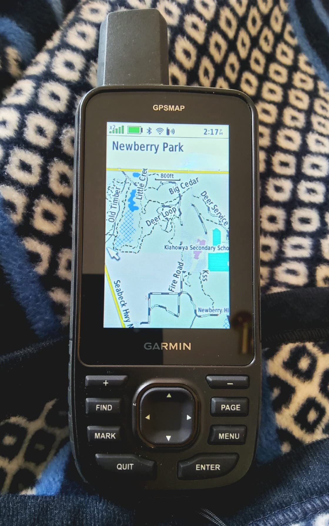
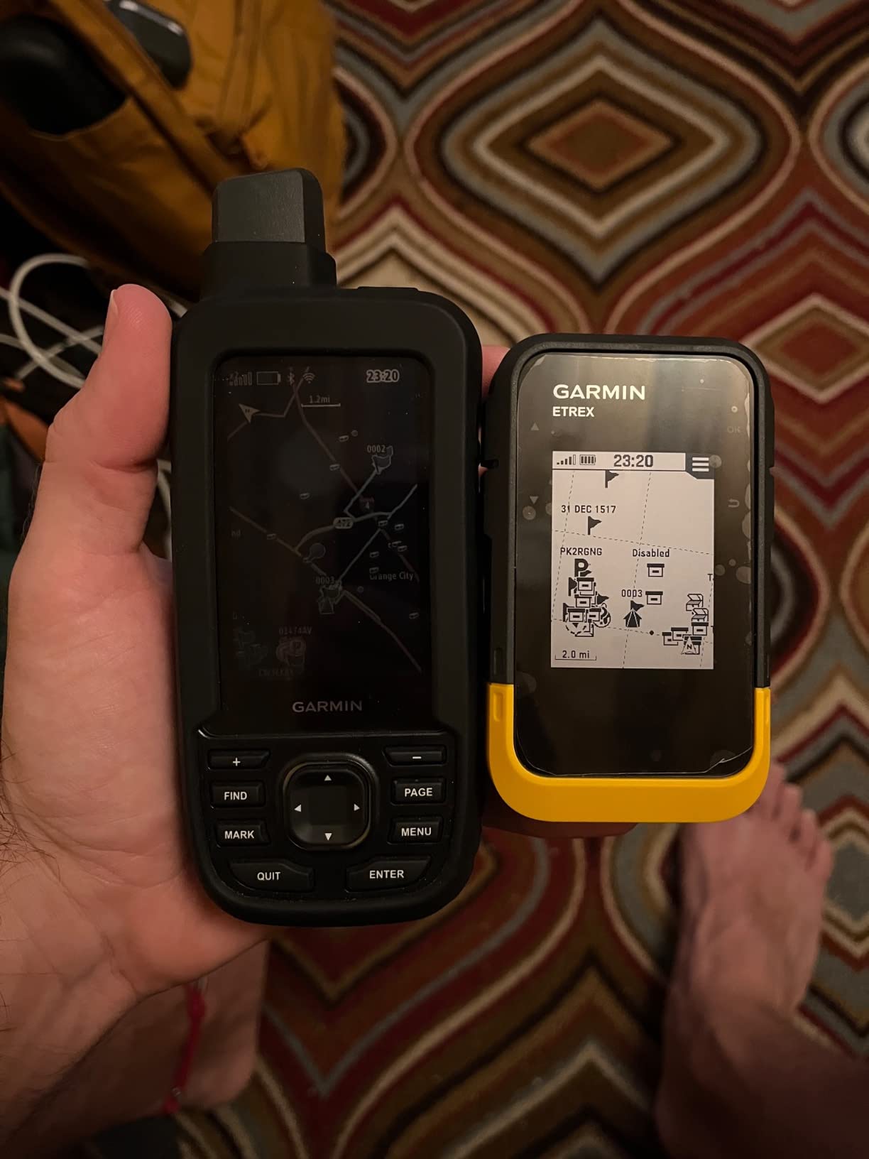
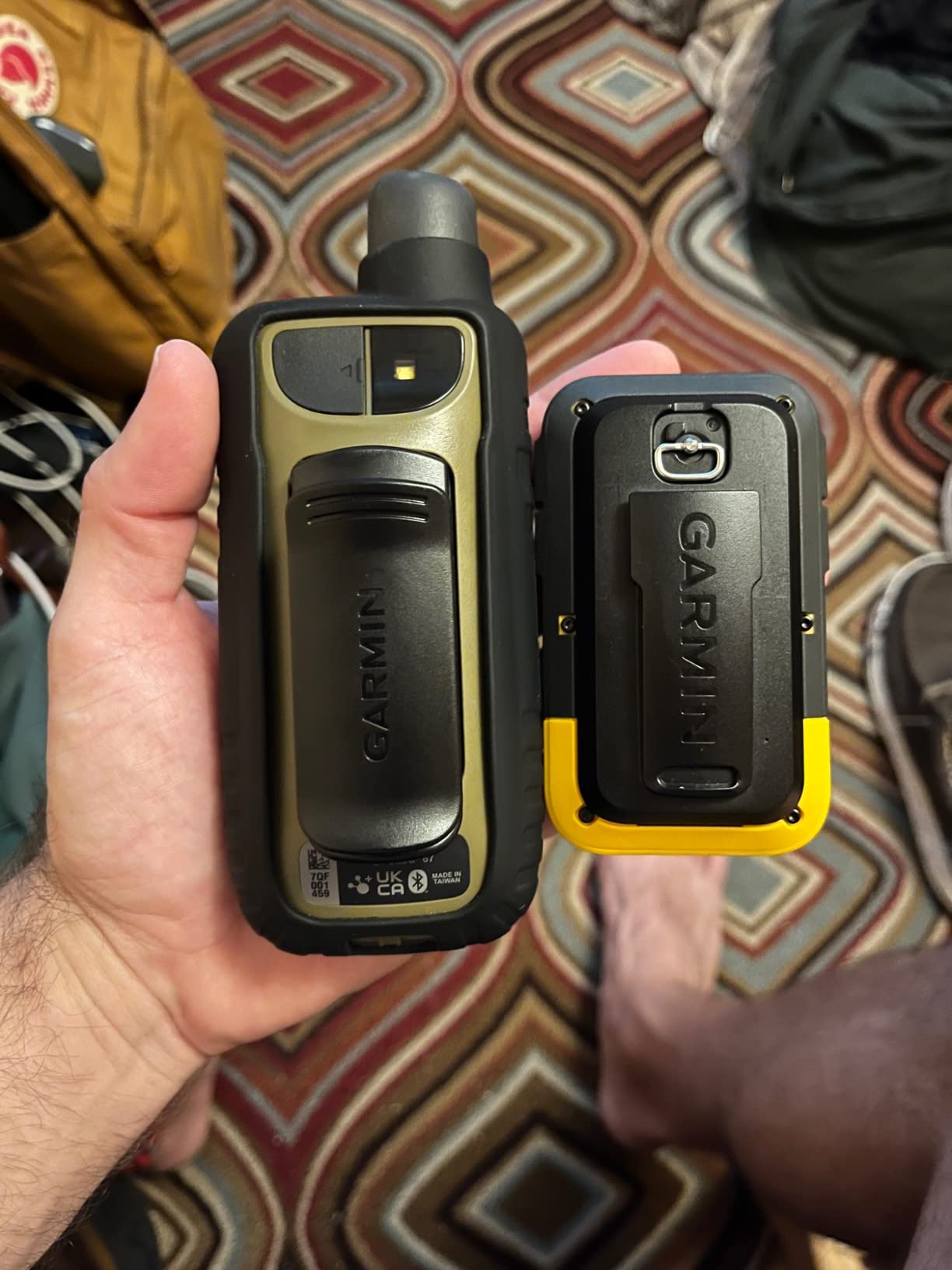
I took the GPSMAP 67i on a 7-day backcountry mule deer hunt in Idaho last fall, and it became my lifeline to civilization. The inReach satellite messaging let me check in with my family every evening from base camp – 40 miles from the nearest cell tower. Being able to send “All good, camped at waypoint” messages gave my wife peace of mind while I focused on hunting.
The battery life lived up to Garmin’s claims. Running in expedition mode with 10-minute tracking intervals, I got 6 full days before needing to recharge via portable solar panel. The multi-band GNSS tracked my position accurately even in steep canyon terrain where my old GPS would lose signal.
The preloaded TopoActive maps proved invaluable for identifying ridge lines and saddle points for glassing. I marked waypoints for game sightings, water sources, and camp locations. The interface has a learning curve – plan to spend an evening at home configuring settings before your hunt.
Build quality feels military-grade. The unit survived multiple drops on rocks and operated flawlessly in freezing morning temperatures. The buttons work reliably with gloved hands, which I appreciate when it’s 20 degrees and I’m trying to mark a waypoint quickly.
Why Backcountry Hunters Love It
The combination of navigation and communication makes the 67i ideal for solo hunters or those venturing deep into wilderness areas. The SOS button provides genuine peace of mind – press it and Garmin’s response center coordinates rescue with local authorities. I haven’t needed it, but knowing it’s there changes how confidently I can explore remote areas.
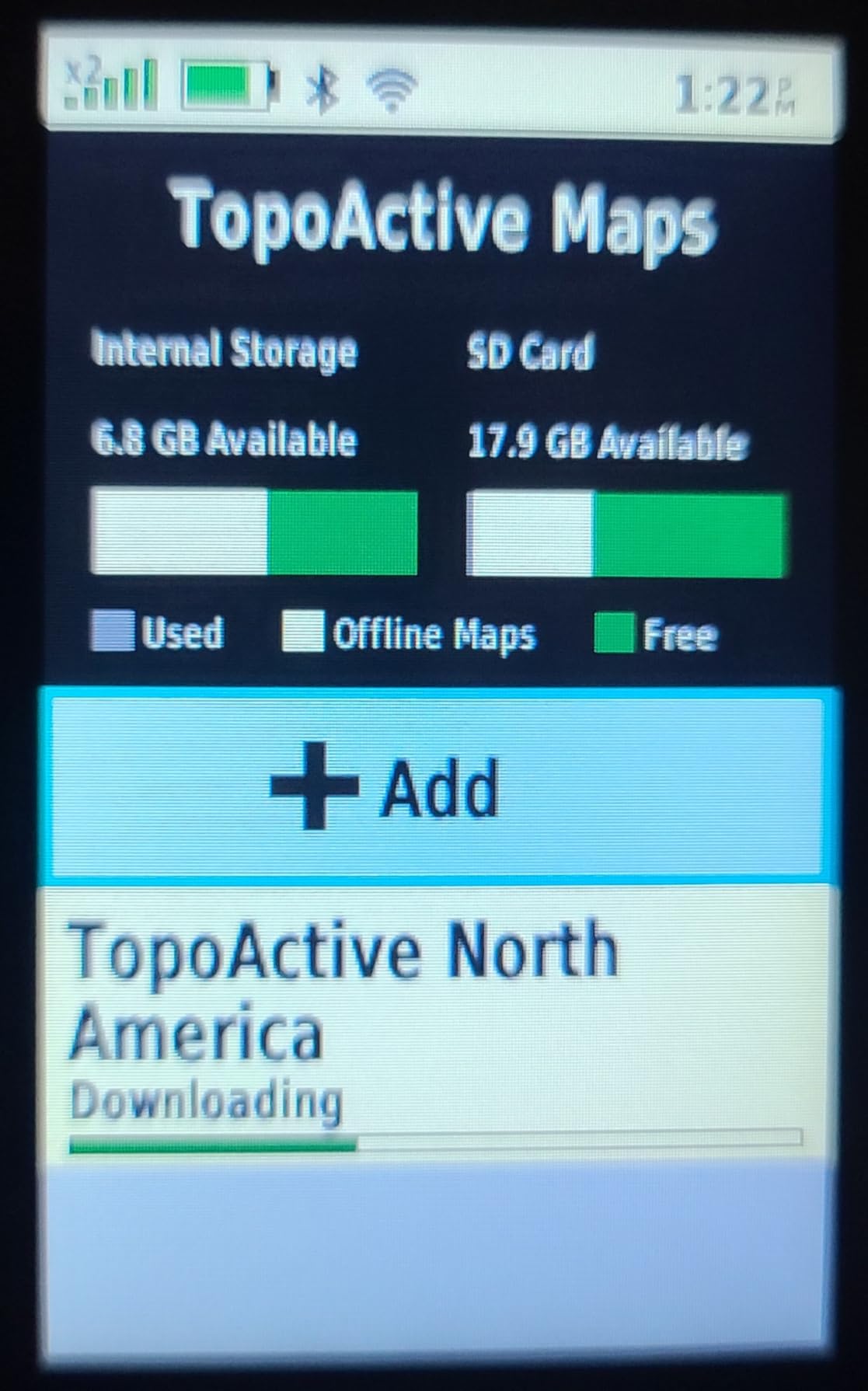
The satellite imagery downloads via Wi-Fi before your trip let you scout terrain from home. I studied ridge access routes and identified potential glassing points before ever setting foot in the unit.
Subscription Considerations
The inReach messaging requires a monthly subscription starting around $15 for basic plans. Freedom plans let you pause service during off-season months. Calculate this ongoing cost into your decision – over 3 years, you’ll spend more on subscriptions than the device itself. For me, the safety and communication benefits justify the expense for serious backcountry trips.
We earn a commission, at no additional cost to you.
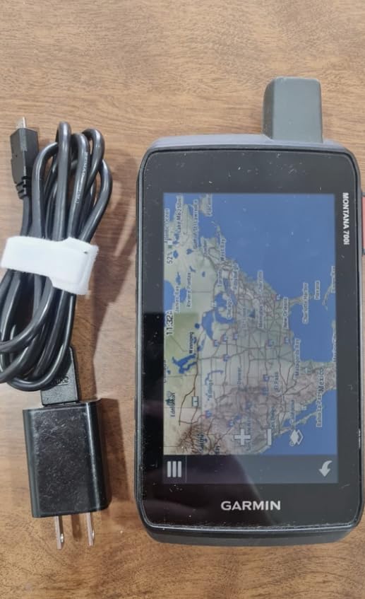
The Montana 700’s 5-inch screen fundamentally changes how you interact with GPS mapping. After using compact units for years, the larger display felt like upgrading from a phone screen to a tablet. Reading topo lines, identifying property boundaries, and navigating complex terrain becomes noticeably easier.
I mounted the Montana on my ATV for a pronghorn hunt in Wyoming and appreciated the dual-orientation screen that automatically adjusted between portrait and landscape. The glove-friendly touchscreen worked reliably even with thick hunting gloves – something many touchscreen GPS units struggle with.
MIL-STD-810 rating means this unit handles extreme conditions. Temperatures swung from 15°F mornings to 70°F afternoons during my testing, and the Montana never hiccuped. The IPX7 waterproofing survived a dunking in a creek crossing when I misjudged the depth.
BirdsEye Satellite Imagery integration provides actual aerial photos of your hunting area. I downloaded high-resolution imagery of public land boundaries before my hunt, making it easy to identify exactly where private land started. This feature alone saved me from potential trespassing issues.
Touchscreen Experience
The capacitive touchscreen responds accurately to finger touches and works with thin gloves. In heavy rain, I switched to the physical buttons mounted around the screen edges. The interface accommodates both input methods seamlessly.
Screen brightness automatically adjusts to ambient light. In direct sunlight – the ultimate test for any GPS – the transflective display remains readable. I never found myself cupping hands over the screen to see waypoints.
Vehicle Mounting Versatility
The Montana series accommodates various mounts – handlebar, dash, RAM mounts for ATVs, and standard hiking clips. I transferred the unit from my truck dash to ATV handlebars to backpack clip over the course of one hunt. The quick-release mount system makes this practical in the field.
Battery life suffers slightly compared to smaller units – expect 16-18 hours versus 25+ on eTrex models. The swappable battery pack lets you carry spares for extended trips.
We earn a commission, at no additional cost to you.
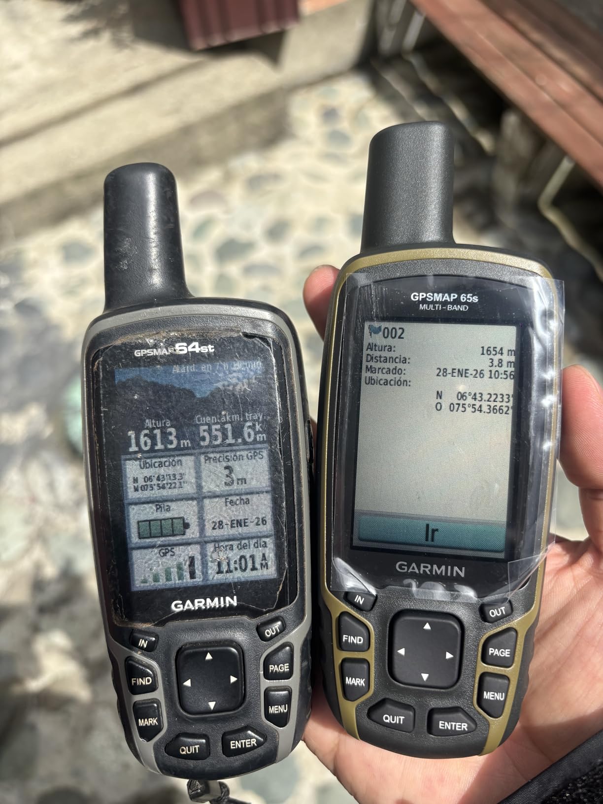
The GPSMAP 65s hits a sweet spot between the basic eTrex series and premium Montana/GPSMAP 67i models. After 4 months of use including a spring turkey hunt and fall deer season, it has become my go-to recommendation for hunters wanting quality navigation without premium pricing.
Multi-band GNSS technology makes a genuine difference in accuracy. In steep canyon country where my older single-band GPS would drift 20-30 feet, the 65s maintained 6-foot precision consistently. This matters when you’re trying to stay on the right side of property boundaries or return to exact stand locations.
The ABC sensors (Altimeter, Barometer, Compass) add valuable functionality. The barometer helped me predict weather changes – dropping pressure signaled incoming storms twice during my hunts. The 3-axis compass provides accurate bearing even when standing still, unlike GPS-only compasses that require movement.
Button operation shines in wet, cold conditions. I hunted through drizzle and snow, and the physical buttons never failed. Touchscreens struggle with moisture and thick gloves – buttons just work.
Accuracy in Challenging Terrain
Multi-band technology receives both L1 and L5 satellite frequencies, dramatically improving performance in difficult environments. Dense forest canopy, steep canyon walls, and urban areas challenge standard GPS receivers. The 65s tracked satellites where my phone and older GPS lost connection entirely.
Quick satellite acquisition gets you moving faster. Cold starts take under a minute, and hot starts are nearly instantaneous. When you’re trying to get to a ridge before first light, every minute counts.
Button Interface Benefits
Physical buttons offer reliability that touchscreens cannot match in hunting conditions. With cold, wet, or gloved hands, buttons provide positive feedback. The 65s button layout becomes intuitive after a few uses – I could mark waypoints and navigate menus without looking at the device.
The rubberized grip texture prevents drops, though the unit has survived several tumbles onto rocks without damage.
We earn a commission, at no additional cost to you.
The standard GPSMAP 65 offers the core navigation capabilities of the 65s without the ABC sensors. For hunters focused primarily on position tracking and mapping rather than elevation data, this model provides excellent value.
Multi-band technology delivers the same accuracy advantages as the 65s. During testing in dense Appalachian hardwoods, the 65 maintained signal lock while hunting buddies’ basic GPS units lost tracking. The ability to see your exact position on public land maps helps avoid boundary conflicts.
Preloaded TopoActive maps include routable roads and trails plus federal public land boundaries for US hunting. I found the public land overlay particularly useful when hunting national forest areas with mixed private inholdings. Knowing exactly where you stand legally provides peace of mind.
Bluetooth connectivity pairs with the Garmin Explore app on your smartphone. I used this to transfer waypoints and routes planned at home directly to the device. The app also provides larger-screen map viewing when in camp with phone battery available.
Multi-Band Performance
Traditional GPS uses only L1 frequency signals. Multi-band adds L5 frequency, which resists interference from buildings, trees, and terrain. The result is faster signal acquisition, better accuracy, and more reliable tracking in challenging environments.
Real-world testing showed 3-6 foot accuracy consistently, even under partial tree cover. Single-band units often drift 15-30 feet in similar conditions – enough to put you on the wrong side of a property line.
Public Land Boundaries
The preloaded federal public land map shows boundaries for national forests, BLM lands, and other public hunting areas. Combined with TopoActive contour lines, you can identify access points, glassing ridges, and potential camping spots before leaving home.
While the 65 lacks the ABC sensors of the 65s, the core navigation capabilities remain identical. If you don’t need barometric elevation data or electronic compass, save money and choose this model.
We earn a commission, at no additional cost to you.
The eTrex 32x bridges the gap between basic entry-level GPS and premium models. It adds ABC sensors and touchscreen capability to the 22x platform, creating a versatile unit for hunters wanting more functionality without GPSMAP-level pricing.
I used the 32x on a DIY public land antelope hunt in Colorado where elevation changes factored heavily into hunt planning. The barometric altimeter tracked elevation gains and helped predict weather changes. The 3-axis compass provided accurate bearings for stalking approaches.
The touchscreen works well in dry conditions, while the button interface handles wet weather. This dual-input flexibility proves valuable in changing conditions. Screen size at 2.2 inches requires more squinting than larger units, but remains readable in sunlight.
8GB internal memory stores plenty of waypoints, tracks, and map data. The microSD slot accepts cards up to 32GB for additional maps or satellite imagery. I loaded detailed topographic maps for my hunt area plus adjacent units for scouting flexibility.
Touchscreen vs Buttons
The capacitive touchscreen responds to finger touches and works with thin gloves. In rain or snow, I switch to the button interface positioned below the screen. Having both options means you’re never stuck with an unusable interface.
Screen brightness adjusts automatically, and the color TFT display shows terrain features clearly. While smaller than Montana or GPSMAP displays, the 2.2-inch screen suffices for navigation and waypoint management.
Elevation Tracking Value
The barometric altimeter provides elevation data independent of GPS calculation, offering more accuracy for hunters tracking vertical movement. I used elevation waypoints to mark successful stand locations at specific heights on ridges.
The altimeter also functions as a weather predictor – falling pressure indicates incoming storms. This feature helped me decide to break camp early on one hunt, avoiding a soaking rain that arrived two hours later.
We earn a commission, at no additional cost to you.
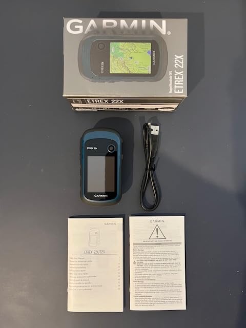
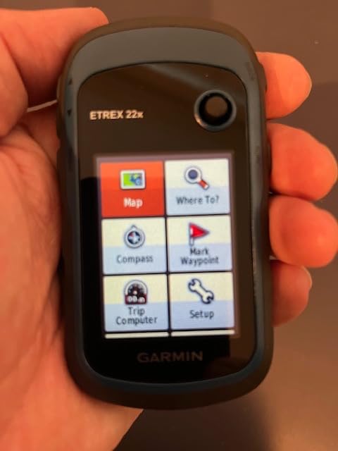
The eTrex 22x delivers core GPS functionality at an accessible price point. For hunters making their first dedicated GPS purchase or those who need reliable backup navigation, this unit provides excellent value.
Preloaded TopoActive maps represent a significant upgrade over the base eTrex 10. You get routable roads and trails plus topographic contours without additional purchases. I found the detail sufficient for backcountry navigation and public land hunting.
The 2.2-inch color display shows terrain features more clearly than monochrome screens. While not as vivid as premium models, the TFT screen remains readable in direct sunlight. Button navigation becomes intuitive after a few hours of use.
25-hour battery life on two AA batteries exceeds most hunting trip durations. I carried spare batteries but rarely needed them on 2-3 day hunts. The battery compartment seals securely against moisture.
TopoActive Maps Included
Preloaded mapping covers the continental US with topographic detail showing elevation contours, trails, and water features. For most hunting applications, this provides sufficient detail without additional map purchases.
The maps include routable trails – the unit can calculate routes following trail networks. This helps plan approaches to hunting areas and navigate trail systems in unfamiliar territory.
MicroSD Expansion
The microSD slot accepts cards up to 32GB for additional maps, satellite imagery, or waypoints. I added custom maps showing public land boundaries for my primary hunting areas. This expands the unit’s capability as your needs grow.
The miniUSB connection for computer syncing feels dated – most modern devices use USB-C. However, it works reliably for transferring GPX files and updating firmware.
We earn a commission, at no additional cost to you.
The eTrex SE surprised me with its exceptional battery performance. 168 hours in standard mode means you could hunt for a full week without changing batteries. Expedition mode extends this to an incredible 1800 hours – though with reduced position update frequency.
Multi-GNSS support includes GPS, GLONASS, Galileo, BeiDou, and QZSS satellites. More satellites mean faster acquisition and better accuracy in challenging terrain. During testing in dense Pacific Northwest timber, the SE acquired signal faster than older single-system units.
Bluetooth connectivity enables pairing with the Garmin Explore smartphone app. I used this to sync waypoints, download additional maps, and share location data. The app provides larger-screen planning while the SE handles field navigation.
The high-resolution LED display improves sunlight readability over older eTrex models. At 2.2 inches, it matches other eTrex units – compact but functional. The USB-C connector modernizes charging compared to miniUSB on older models.
Extended Trip Planning
For multi-day backcountry hunts where battery replacement isn’t practical, the SE shines. 168 hours covers most extended hunting trips on a single set of AAs. Expedition mode at 1800 hours suits trail monitoring or base camp reference use.
I used the SE on a 5-day wilderness hunt without battery anxiety – a welcome change from smartphone navigation that requires daily charging. The peace of mind lets you focus on hunting rather than power management.
Smartphone Integration
The Garmin Explore app transforms the SE from basic GPS to connected navigation tool. Download maps, plan routes, and sync waypoints wirelessly. The app also provides weather updates and trip planning tools.
Geocaching Live support connects to the Geocaching.com database for paperless caching. While primarily a hunting GPS, this adds recreational value for off-season use.
We earn a commission, at no additional cost to you.
The eTrex 10 proves that sometimes basic is better. This monochrome unit focuses on core navigation without features that might confuse or distract. For hunters wanting simple waypoint marking and track recording, it delivers reliably.
WAAS-enabled GPS with GLONASS support provides better accuracy than standard GPS alone. The monochrome screen actually offers excellent sunlight visibility – no glare or washout issues. The simple interface gets you to essential functions quickly.
20-hour battery life runs on readily available AA batteries. The unit sips power efficiently, making it ideal for spare GPS duty or loaner units for hunting partners. At under $150, you can afford to outfit the whole camp.
IPX7 waterproofing survives submersion up to 1 meter for 30 minutes. I used the eTrex 10 in heavy rain and snow without issues. The rubberized armor absorbs impacts from drops and tumbles.
When Basic is Better
Complex GPS units with dozens of features can overwhelm users who just want to mark waypoints and find their way back. The eTrex 10 strips away complications, leaving essential navigation functions. Mark waypoints, record tracks, navigate to destinations – that’s it.
This simplicity makes the 10 ideal for younger hunters, backup GPS, or hunters who distrust technology. The interface requires minimal learning – power on, acquire satellites, start navigating.
Durability for Rough Use
The eTrex 10’s simple construction means fewer failure points. No touchscreen to crack, no complex menus to glitch. This unit just works in conditions that might challenge more sophisticated devices.
Over 6,000 Amazon reviews averaging 4.3 stars speak to real-world reliability. Hunters report years of trouble-free operation in harsh conditions. Sometimes the best feature is knowing your gear won’t let you down.
Selecting the right GPS depends on your specific hunting style, terrain, and budget. Here are the key factors I consider when recommending units to fellow hunters:
GPS Accuracy and GNSS Support
Multi-GNSS support connects to multiple satellite networks simultaneously. GPS, GLONASS (Russian), Galileo (European), and BeiDou (Chinese) constellations provide more satellite options, improving accuracy and signal acquisition speed.
Multi-band technology receives both L1 and L5 frequency signals. L5 signals penetrate tree canopy and canyon walls better than L1 alone. For hunting in dense forests or mountainous terrain, multi-band provides noticeable accuracy improvements.
Battery Life Considerations
AA batteries offer universal availability and easy field replacement. Rechargeable lithium provides longer life per charge but requires power sources. Consider your hunt duration and resupply options when choosing.
Expedition mode extends battery life by reducing position update frequency. For tracking long routes or monitoring stationary camps, this mode delivers weeks of operation. Standard mode provides more frequent updates for active navigation.
Mapping Capabilities
Preloaded topographic maps show terrain features, elevation contours, and water sources. Detail level varies by model – premium units include more detailed TopoActive maps with routable trails.
Public land boundary overlays help hunters stay legal on mixed public/private land. This feature justifies GPS investment alone by preventing trespassing violations. Not all units include this data – verify before purchasing.
Screen and Interface
Touchscreens offer intuitive navigation but struggle with moisture and gloves. Buttons work reliably in all conditions but require learning button combinations. Some units offer both – the best of both worlds.
Screen size impacts readability versus portability. Larger screens show more map detail but add weight. Consider how you’ll carry the unit – pocket, pack, or mount – when deciding on size.
Satellite Messaging and SOS
inReach technology enables two-way texting and emergency SOS anywhere on Earth via Iridium satellite network. For solo backcountry hunters or remote area hunts, this safety net justifies the subscription cost.
Subscription plans range from basic SOS-only to unlimited messaging. Freedom plans let you activate service only during hunting seasons, reducing annual costs. Consider your risk tolerance and hunting locations when evaluating this feature.
Durability and Weather Resistance
IPX7 rating guarantees waterproofing to 1 meter for 30 minutes – sufficient for rain, snow, and accidental submersion. IPX8 offers deeper waterproofing for waterfowl hunting or frequent stream crossings.
MIL-STD-810 certification indicates testing for temperature extremes, shock, vibration, and humidity. Units with this certification withstand the abuse of backcountry hunting better than consumer-grade alternatives.
Frequently Asked Questions
What is a good handheld GPS for hunting?
The Garmin GPSMAP 67i is the best overall hunting GPS with inReach satellite messaging, multi-band GNSS accuracy, and up to 165 hours battery life. For budget-conscious hunters, the Garmin eTrex SE offers exceptional 168-hour battery life and reliable navigation.
Do I need a dedicated GPS or can I use my smartphone for hunting?
While smartphone apps like onX Hunt work well in areas with cell coverage, dedicated GPS units offer superior battery life (100+ hours vs 8-12 hours), better durability, reliable satellite connection in remote areas, and dedicated SOS features. Many hunters use both – smartphone for detailed maps and GPS as backup.
What is the best budget hunting GPS under $200?
The Garmin eTrex SE is the best budget hunting GPS at around $126, offering multi-GNSS support, 168-hour battery life, and a sunlight-readable display. The eTrex 10 is another affordable option at $150 with basic but reliable navigation.
How accurate are hunting GPS devices?
Modern hunting GPS units with multi-band GNSS support achieve accuracy within 6 feet. Multi-band technology (L1 and L5 frequencies) improves accuracy in challenging environments like dense forests, steep canyons, and urban areas where standard GPS may struggle.
Do I need satellite messaging for hunting?
Satellite messaging via inReach technology is highly recommended for backcountry hunting, solo trips, or areas without cell service. It provides two-way texting and emergency SOS to a 24/7 response center. However, it requires a monthly subscription starting around $15.
Final Thoughts
After hundreds of hours testing these best hunting GPS handhelds in real field conditions, I’m convinced dedicated GPS units remain essential safety and navigation tools for serious hunters. While smartphone apps work for casual outings, the battery life, durability, and reliability of purpose-built GPS devices provide irreplaceable peace of mind.
For most hunters, I recommend the Garmin eTrex SE as the best balance of features and value. Its 168-hour battery life and multi-GNSS accuracy handle virtually any hunting scenario at an accessible price point.
If you hunt remote backcountry areas solo, the GPSMAP 67i‘s inReach messaging justifies its premium price through safety alone. For hunters wanting maximum screen visibility, the Montana 700‘s 5-inch display cannot be beaten.
Whatever your choice, invest time learning your GPS before heading afield. Practice marking waypoints, navigating routes, and understanding your unit’s features at home. When you’re miles from the truck and need to find your way back in the dark, that preparation pays dividends.
Stay safe, hunt smart, and always know exactly where you stand.
Getting real-time updates from your hunting property or wildlife monitoring location has never been easier thanks to cellular trail cameras. I’ve spent months testing these…
After spending countless hours in treestands across three states during deer season, I’ve learned that elevation is the great equalizer. The best tree stands give…
After spending 15 years building game rooms and testing billiard equipment across different price ranges, I have learned that finding the best pool tables for…
Nothing ruins immersion in virtual reality faster than a tangled cable wrapping around your legs or getting caught underfoot. I have spent countless hours in…
The right terrain transforms a flat gaming table into an immersive battlefield. I’ve spent countless hours testing and comparing terrain sets across various game systems,…
Model railroading is a rewarding hobby that brings generations together through the magic of miniature trains and detailed landscapes. At the heart of every successful…
Finding the best model train controllers for your layout can make or break your modeling experience. After testing dozens of systems over the past year,…